Earthquake damage
Introduction
The photograph on this page of Earthquake damage by Richard Croft as part of the Geograph project.
The Geograph project started in 2005 with the aim of publishing, organising and preserving representative images for every square kilometre of Great Britain, Ireland and the Isle of Man.

There are currently over 7.5m images from over 14,400 individuals and you can help contribute to the project by visiting https://www.geograph.org.uk
Earthquake damage
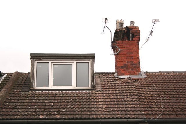
Image: © Richard Croft Taken: 29 Feb 2008
Close-up of the damaged chimney stack at 26 Ashcroft Road http://www.geograph.org.uk/photo/708670 after the earthquake of 27th February 2008
Images are licensed for reuse under creativecommons.org/licenses/by-sa/2.0
Image Location
Latitude
53.390633
Longitude
-0.773561