Wayside Cross, Milkwall
Introduction
The photograph on this page of Wayside Cross, Milkwall by Mr Red as part of the Geograph project.
The Geograph project started in 2005 with the aim of publishing, organising and preserving representative images for every square kilometre of Great Britain, Ireland and the Isle of Man.

There are currently over 7.5m images from over 14,400 individuals and you can help contribute to the project by visiting https://www.geograph.org.uk
Wayside Cross, Milkwall
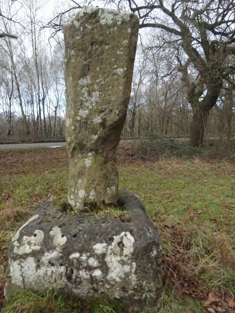
Image: © Mr Red Taken: 1 Feb 2022
Base and shaft of a cross, with an OS Benchmark on the West face of the base. Near to Scar Bandstand and the B4228 just in the parish of West Dean. In a parcel of land, seemingly left fallow. No discernable inscription, some minor scratched graffiti. A similar style of cross is seen at Image Labelled on maps variously as Gattle's/Battle's/Cattle's Cross, the "G" would appear to be the local (and definitive) version. It dates from the 17c or 18c. Listed by Gloucestershire County Council as a monument, more information https://www.heritagegateway.org.uk/Gateway/Results_Single.aspx?uid=5072&resourceID=108 Milestone Society National ID: GLFD_WDE
Images are licensed for reuse under creativecommons.org/licenses/by-sa/2.0
Image Location
Latitude
51.773667
Longitude
-2.608362