King Street Railway Bridge abutment
Introduction
The photograph on this page of King Street Railway Bridge abutment by Adrian Taylor as part of the Geograph project.
The Geograph project started in 2005 with the aim of publishing, organising and preserving representative images for every square kilometre of Great Britain, Ireland and the Isle of Man.

There are currently over 7.5m images from over 14,400 individuals and you can help contribute to the project by visiting https://www.geograph.org.uk
King Street Railway Bridge abutment
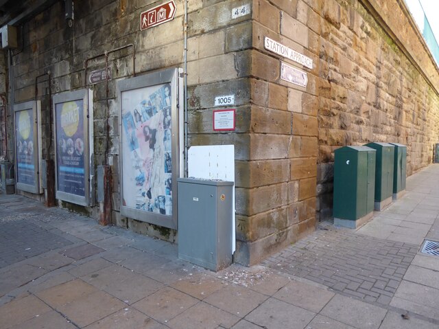
Image: © Adrian Taylor Taken: 27 Jan 2022
Cluttered by a scruffy assortment of signs, notices, pipes, advertisements and equipment cabinets this bridge does little to enhance South Shield’s main shopping street. There is an Ordnance Survey cut benchmark low down near the corner of the abutment (photograph Image). The bridge carries an extension of the Tyne and Wear Metro leading to the South Shields Depot.
Images are licensed for reuse under creativecommons.org/licenses/by-sa/2.0
Image Location
Latitude
54.998516
Longitude
-1.433538