Hall Close moated site, Scredington: aerial 2022
Introduction
The photograph on this page of Hall Close moated site, Scredington: aerial 2022 by Simon Tomson as part of the Geograph project.
The Geograph project started in 2005 with the aim of publishing, organising and preserving representative images for every square kilometre of Great Britain, Ireland and the Isle of Man.

There are currently over 7.5m images from over 14,400 individuals and you can help contribute to the project by visiting https://www.geograph.org.uk
Hall Close moated site, Scredington: aerial 2022
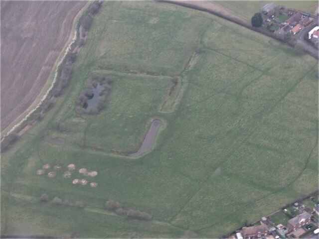
Image: © Simon Tomson Taken: 23 Jan 2022
Moated enclosure now in pasture, the moat mainly drained. Originally the principal moat in a village with five. The others have been excavated and/or destroyed. Surrounding the moat in the remainder of Hall Close are the platforms and enclosures of the original village settlement. There were several important families in the village during the Middle Ages. The most prominent, the Pylets, occupied Hall Close from the late 12th to the mid 15th century. The earthworks include the remains of fish ponds and a boundary ditch which would have enclosed the whole manorial complex. See: https://www.heritagegateway.org.uk/Gateway/Results_Single.aspx?uid=MLI60728&resourceID=1006
Images are licensed for reuse under creativecommons.org/licenses/by-sa/2.0
Image Location
Latitude
52.953263
Longitude
-0.373787