Valley between An Garbh-chnoc and Beinn Bhreac
Introduction
The photograph on this page of Valley between An Garbh-chnoc and Beinn Bhreac by Dr. Derrick Sherwin Bailey as part of the Geograph project.
The Geograph project started in 2005 with the aim of publishing, organising and preserving representative images for every square kilometre of Great Britain, Ireland and the Isle of Man.

There are currently over 7.5m images from over 14,400 individuals and you can help contribute to the project by visiting https://www.geograph.org.uk
Valley between An Garbh-chnoc and Beinn Bhreac
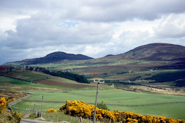
Image: © Dr. Derrick Sherwin Bailey Taken: Unknown
Seen from road running northwards to Tongue. The hill on the right is Beinn Bhreac, whilst that beyond in centre is Ben Tongue. The two buildings in the green field below Beinn Bhreac are Hysbackie. In the modern Streetview image https://goo.gl/maps/Zobxxka8uA3z4MaZA the telephone poles have gone.
Images are licensed for reuse under creativecommons.org/licenses/by-sa/2.0
Image Location


Leaflet Map data © OpenStreetMap
Latitude
58.464835
Longitude
-4.422203