Alcove, Coombe Shute, Stoke Gabriel
Introduction
The photograph on this page of Alcove, Coombe Shute, Stoke Gabriel by Derek Harper as part of the Geograph project.
The Geograph project started in 2005 with the aim of publishing, organising and preserving representative images for every square kilometre of Great Britain, Ireland and the Isle of Man.

There are currently over 7.5m images from over 14,400 individuals and you can help contribute to the project by visiting https://www.geograph.org.uk
Alcove, Coombe Shute, Stoke Gabriel
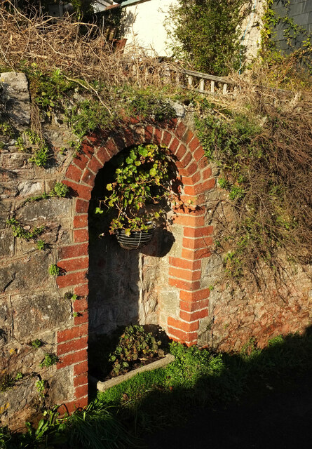
Image: © Derek Harper Taken: 17 Jan 2022
On the stretch of lane shown in Image This must be the "arched water collection point" mentioned in https://www.southhams.gov.uk/media/1411/Stoke-Gabriel/pdf/stoke_gabriel_conservation_area_appraisal.pdf .
Images are licensed for reuse under creativecommons.org/licenses/by-sa/2.0
Image Location
Latitude
50.403753
Longitude
-3.6193