Otham houses [5]
Introduction
The photograph on this page of Otham houses [5] by Michael Dibb as part of the Geograph project.
The Geograph project started in 2005 with the aim of publishing, organising and preserving representative images for every square kilometre of Great Britain, Ireland and the Isle of Man.

There are currently over 7.5m images from over 14,400 individuals and you can help contribute to the project by visiting https://www.geograph.org.uk
Otham houses [5]
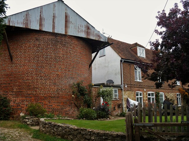
Image: © Michael Dibb Taken: 11 Sep 2021
Attached to the house and used as a store is this large, former oasthouse. Built in the early 18th century and altered in the 19th century. Constructed or red and grey brick. Listed, grade II, with details at: https://historicengland.org.uk/listing/the-list/list-entry/1263013 Otham is a small, widely spread village, on the southeastern edge of Maidstone, some 2¾ miles from the town centre and 15 miles northwest of Ashford. There are plans to add another 1250 houses to the village which currently has 204 dwellings.
Images are licensed for reuse under creativecommons.org/licenses/by-sa/2.0
Image Location
Latitude
51.250456
Longitude
0.573983