Otham features [4]
Introduction
The photograph on this page of Otham features [4] by Michael Dibb as part of the Geograph project.
The Geograph project started in 2005 with the aim of publishing, organising and preserving representative images for every square kilometre of Great Britain, Ireland and the Isle of Man.

There are currently over 7.5m images from over 14,400 individuals and you can help contribute to the project by visiting https://www.geograph.org.uk
Otham features [4]
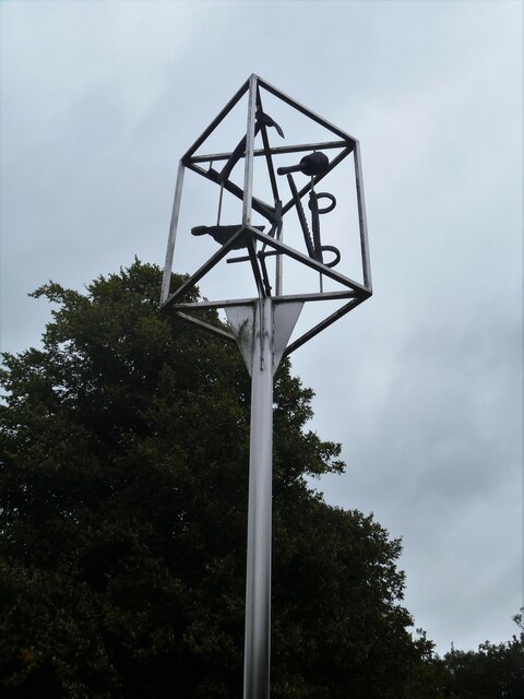
Image: © Michael Dibb Taken: 11 Sep 2021
The village sign was erected in 1994 for the centenary of the parish council. A plaque reads 'Otham Parish Council 1894-1994 the tools that shaped our village'. Otham is a small, widely spread village, on the southeastern edge of Maidstone, some 2¾ miles from the town centre and 15 miles northwest of Ashford. There are plans to add another 1250 houses to the village which currently has 204 dwellings.
Images are licensed for reuse under creativecommons.org/licenses/by-sa/2.0
Image Location
Latitude
51.253664
Longitude
0.575309