Shipyard history board, Beverley
Introduction
The photograph on this page of Shipyard history board, Beverley by Paul Harrop as part of the Geograph project.
The Geograph project started in 2005 with the aim of publishing, organising and preserving representative images for every square kilometre of Great Britain, Ireland and the Isle of Man.

There are currently over 7.5m images from over 14,400 individuals and you can help contribute to the project by visiting https://www.geograph.org.uk
Shipyard history board, Beverley
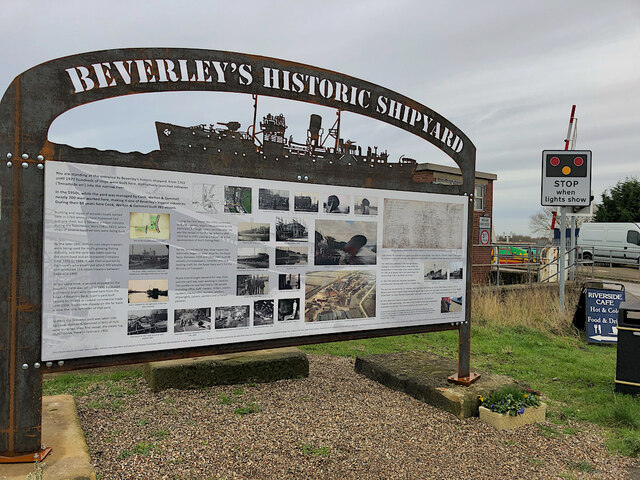
Image: © Paul Harrop Taken: 11 Jan 2022
Sited at the junction of Grovehill Road and Riverview Road, the memorial archway display board is at the entrance to the site of the town's former shipyard next to the River Hull. The information board has numerous photographs of the once-substantial shipyard, with explanatory text about what is maybe one of the lesser-known aspects of Beverley's history. The former shipbuilding industry was considerable, employing over 650 people, building over 1,300 ships, and contributing to Britain’s WW2 effort. Beverley built literally hundreds of trawlers, modifying many for wartime military use.
Images are licensed for reuse under creativecommons.org/licenses/by-sa/2.0
Image Location
Latitude
53.843316
Longitude
-0.399989