Tents and bothy at Barrisdale, 1991
Introduction
The photograph on this page of Tents and bothy at Barrisdale, 1991 by Trevor Littlewood as part of the Geograph project.
The Geograph project started in 2005 with the aim of publishing, organising and preserving representative images for every square kilometre of Great Britain, Ireland and the Isle of Man.

There are currently over 7.5m images from over 14,400 individuals and you can help contribute to the project by visiting https://www.geograph.org.uk
Tents and bothy at Barrisdale, 1991
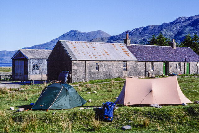
Image: © Trevor Littlewood Taken: 30 May 1991
Two tents, (there were others), and the bothy / bunkhouse at Barrisdale in perfect weather for making ascents to the three Munros in the vicinity. Another Munro is in view distantly at the centre of the image: Beinn Sgritheall, across Loch Hourn, a small section of which can be seen.
Images are licensed for reuse under creativecommons.org/licenses/by-sa/2.0
Image Location
Latitude
57.079636
Longitude
-5.513594