Bridleway heading towards Quarrington Hill
Introduction
The photograph on this page of Bridleway heading towards Quarrington Hill by Trevor Littlewood as part of the Geograph project.
The Geograph project started in 2005 with the aim of publishing, organising and preserving representative images for every square kilometre of Great Britain, Ireland and the Isle of Man.

There are currently over 7.5m images from over 14,400 individuals and you can help contribute to the project by visiting https://www.geograph.org.uk
Bridleway heading towards Quarrington Hill
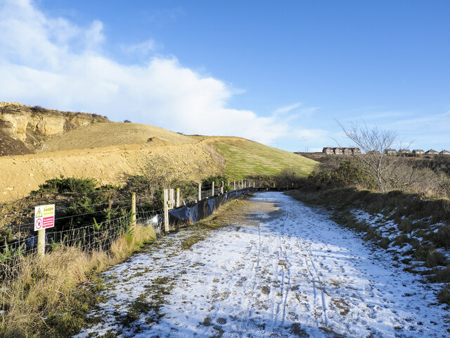
Image: © Trevor Littlewood Taken: 7 Jan 2022
The bridleway, presumably an old industrial / mining route, connects Old Quarrington with Quarrington Hill. The route is in use a s a bridleway which has replaced another bridleway route running above to the left. That is now a private road used for quarry access by the Tarmac company. OS mapping has not, (January 2022), caught up with the changed route situation; an explanation is given here: https://www.geograph.org.uk/photo/7063932 .
Images are licensed for reuse under creativecommons.org/licenses/by-sa/2.0
Image Location
Latitude
54.733723
Longitude
-1.484696