Sandwich houses [5]
Introduction
The photograph on this page of Sandwich houses [5] by Michael Dibb as part of the Geograph project.
The Geograph project started in 2005 with the aim of publishing, organising and preserving representative images for every square kilometre of Great Britain, Ireland and the Isle of Man.

There are currently over 7.5m images from over 14,400 individuals and you can help contribute to the project by visiting https://www.geograph.org.uk
Sandwich houses [5]
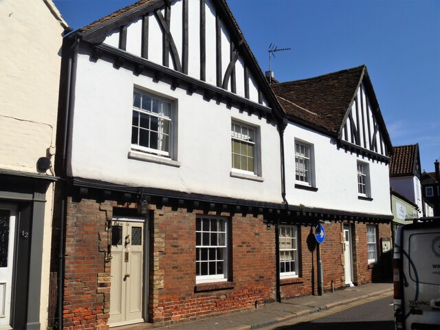
Image: © Michael Dibb Taken: 7 Sep 2021
Number 10 Strand Street is, probably, an early 17th century house. Early in the 20th century the front 10 feet of the house was demolished for road widening. Number 8 adjacent likewise lost the front 10 feet and both houses were given a uniform facade with a jettied first floor and timber-framing exposed in the gables. Timber framed, jettied to the street, ground floor in brick, first floor rendered, all under plain a tile roof. Listed, grade II, with details at: https://historicengland.org.uk/listing/the-list/list-entry/1343831 Sandwich is a historic town in Kent, situated on the River Stour, 11½ miles east of Canterbury and 10½ miles north of Dover. Once a major port, one of the Cinque Ports, the town is now 2 miles inland due to the silting up of the Wantsum Channel. The town has a great many medieval buildings and was once home to a great many Flemish settlers. In Sandwich Bay are two world-class golf courses.
Images are licensed for reuse under creativecommons.org/licenses/by-sa/2.0
Image Location
Latitude
51.275762
Longitude
1.341158