House and schoolroom
Introduction
The photograph on this page of House and schoolroom by Bob Harvey as part of the Geograph project.
The Geograph project started in 2005 with the aim of publishing, organising and preserving representative images for every square kilometre of Great Britain, Ireland and the Isle of Man.

There are currently over 7.5m images from over 14,400 individuals and you can help contribute to the project by visiting https://www.geograph.org.uk
House and schoolroom
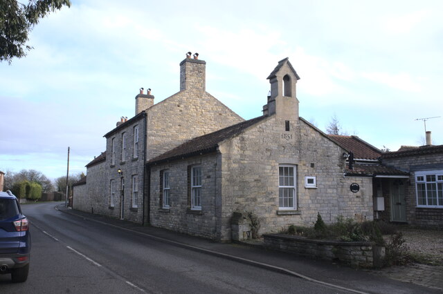
Image: © Bob Harvey Taken: 20 Dec 2020
The small building with a bell cloche is the former schoolroom from the mid 19th century. The adjacent house is the School House. The gable carries the date 1851, which predates by 20 years the Eleemntary eduction act of 1870 - so this is a "voluntary" rather than a "board" school. It will have been funded by the Earl Brownlow and the wealthy villagers for the benefit of the local community. See also https://heritage-explorer.lincolnshire.gov.uk/Monument/MLI97431
Images are licensed for reuse under creativecommons.org/licenses/by-sa/2.0
Image Location
Latitude
52.930495
Longitude
-0.582634