Home Farm Bradpole (Detail)
Introduction
The photograph on this page of Home Farm Bradpole (Detail) by Nigel Mykura as part of the Geograph project.
The Geograph project started in 2005 with the aim of publishing, organising and preserving representative images for every square kilometre of Great Britain, Ireland and the Isle of Man.

There are currently over 7.5m images from over 14,400 individuals and you can help contribute to the project by visiting https://www.geograph.org.uk
Home Farm Bradpole (Detail)
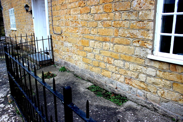
Image: © Nigel Mykura Taken: 11 Feb 2017
This shows the stone construction of the farm house located on Caley Way. It is Inferior Oolite on a plinth of Forest Marble. The inferior oolite may have come from quarries at Allington and the Forest Marble is almost certainly Bothenhampton stone (or Baunton Stone as it was known as locally) from the quarries at Bothenhampton. The forest marble was used on the lower courses because of its low permeability to water. See also Image
Images are licensed for reuse under creativecommons.org/licenses/by-sa/2.0
Image Location
Latitude
50.744365
Longitude
-2.735249