Magnus House and Wentwood
Introduction
The photograph on this page of Magnus House and Wentwood by Ian Capper as part of the Geograph project.
The Geograph project started in 2005 with the aim of publishing, organising and preserving representative images for every square kilometre of Great Britain, Ireland and the Isle of Man.

There are currently over 7.5m images from over 14,400 individuals and you can help contribute to the project by visiting https://www.geograph.org.uk
Magnus House and Wentwood
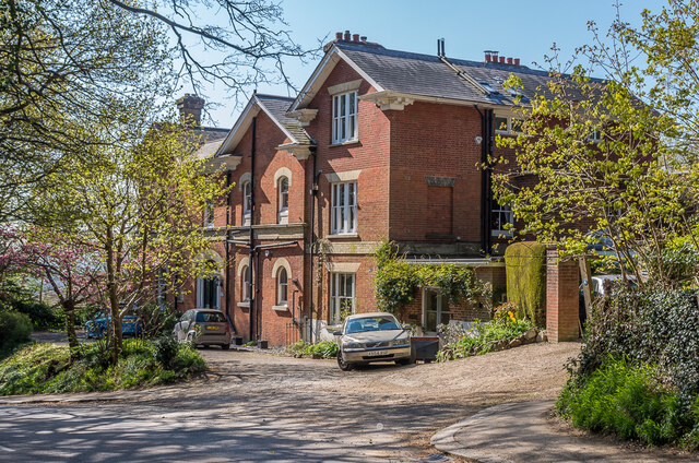
Image: © Ian Capper Taken: 24 Apr 2021
Large mid 19th Century house on Cronks Hill, shown on the 1874 6 inch map as The Knowle and on the 1935 25 inch map as Holcroft, now split into two parts. Large mid 19th Century house on Cronks Hill, shown on the 1874 6 inch map as The Knowle and on the 1935 25 inch map as Holcroft, now split into two parts. The 1963 1:2,500 map names the left hand section (Magnus House) as Magnus Lodge and the right hand section (Wentwood) as Croynes.
Images are licensed for reuse under creativecommons.org/licenses/by-sa/2.0
Image Location
Latitude
51.230501
Longitude
-0.189919