The most probable site of the Ketley Inclined Plane
Introduction
The photograph on this page of The most probable site of the Ketley Inclined Plane by Richard Law as part of the Geograph project.
The Geograph project started in 2005 with the aim of publishing, organising and preserving representative images for every square kilometre of Great Britain, Ireland and the Isle of Man.

There are currently over 7.5m images from over 14,400 individuals and you can help contribute to the project by visiting https://www.geograph.org.uk
The most probable site of the Ketley Inclined Plane
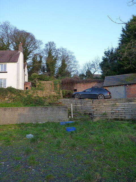
Image: © Richard Law Taken: 1 Jan 2022
Possibly the first successfully-operated and commercially viable Inclined Plane in the UK, built around 1788 as a means of lowering tub boats from the Ketley Canal Image to a long-vanished foundry just to the NW of this point. The boats carried coal and ironstone to the foundry, and were lowered on L-shaped rails with a braking system managed via a windlass at the top of the plane. There seems to be very little (reliable) documented evidence of the exact route of the incline, and if any trace remained 'on the ground' into the 20th century it has been removed by a combination of garden landscaping in the grounds of Hillside Farm on the left here, plus the efforts of Telford Development Corporation from the 1960s onwards. However, a combination of detective work using the best available old maps that we can find, plus some local knowledge from the long-term residents of the farm, suggest that the centre of this photo (ie through the car and the brick outbuilding behind it) tracks the most probable line of the incline. At the top of the garden there is a fence, immediately behind which lies the road bearing the name Image
Images are licensed for reuse under creativecommons.org/licenses/by-sa/2.0
Image Location
Latitude
52.692751
Longitude
-2.477264