Drinking trough, Gunpool Lane, Boscastle
Introduction
The photograph on this page of Drinking trough, Gunpool Lane, Boscastle by Derek Harper as part of the Geograph project.
The Geograph project started in 2005 with the aim of publishing, organising and preserving representative images for every square kilometre of Great Britain, Ireland and the Isle of Man.

There are currently over 7.5m images from over 14,400 individuals and you can help contribute to the project by visiting https://www.geograph.org.uk
Drinking trough, Gunpool Lane, Boscastle
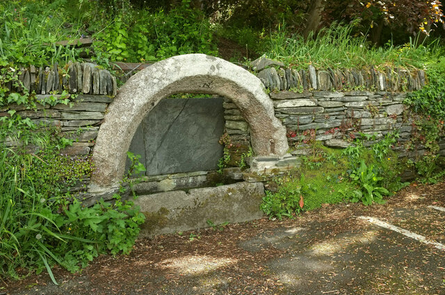
Image: © Derek Harper Taken: 19 May 2021
"A large mid nineteenth century granite drinking trough incorporating sixteenth-century material possibly from the demolished chapel of St James" https://map.cornwall.gov.uk/reports_conservation_areas/Boscastle.pdf .
Images are licensed for reuse under creativecommons.org/licenses/by-sa/2.0
Image Location
Latitude
50.684007
Longitude
-4.692676