Ospringe houses [3]
Introduction
The photograph on this page of Ospringe houses [3] by Michael Dibb as part of the Geograph project.
The Geograph project started in 2005 with the aim of publishing, organising and preserving representative images for every square kilometre of Great Britain, Ireland and the Isle of Man.

There are currently over 7.5m images from over 14,400 individuals and you can help contribute to the project by visiting https://www.geograph.org.uk
Ospringe houses [3]
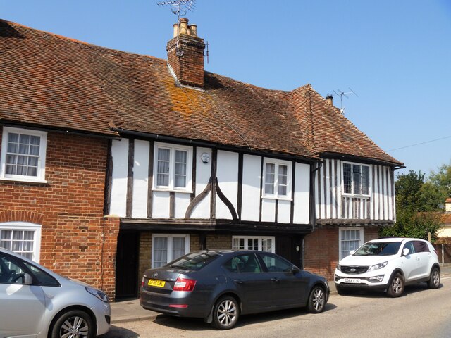
Image: © Michael Dibb Taken: 5 Sep 2021
Tudor Cottages, nearer the camera, and Orchard House are under the same roof span as Bridge Cottage Image Orchard House is 15th century, timber framed with the ground floor rebuilt in red brick. The first floor is stuccoed with studding and jettied to the street. The north front is weatherboarded. There is another view of Orchard House at Image Tudor Cottages were added in the 16th century, timber framed with the round floor rebuilt in brick. The first floor has exposed framing, plaster infill, and is jettied to the street. There is an overall tiled roof. Listed, grade II, with details at: https://historicengland.org.uk/listing/the-list/list-entry/1360991 Ospringe is a village and area of Faversham, Kent. The village lies on the Roman road Watling Street (now the A2). The historic Maison Dieu fronts onto Watling Street and the remains of substantial Roman buildings, thought to be the site of the Durolevum mentioned in the Antonine Itinerary, have been found nearby.
Images are licensed for reuse under creativecommons.org/licenses/by-sa/2.0
Image Location
Latitude
51.310586
Longitude
0.87249