Oakfield Road church
Introduction
The photograph on this page of Oakfield Road church by Neil Owen as part of the Geograph project.
The Geograph project started in 2005 with the aim of publishing, organising and preserving representative images for every square kilometre of Great Britain, Ireland and the Isle of Man.

There are currently over 7.5m images from over 14,400 individuals and you can help contribute to the project by visiting https://www.geograph.org.uk
Oakfield Road church
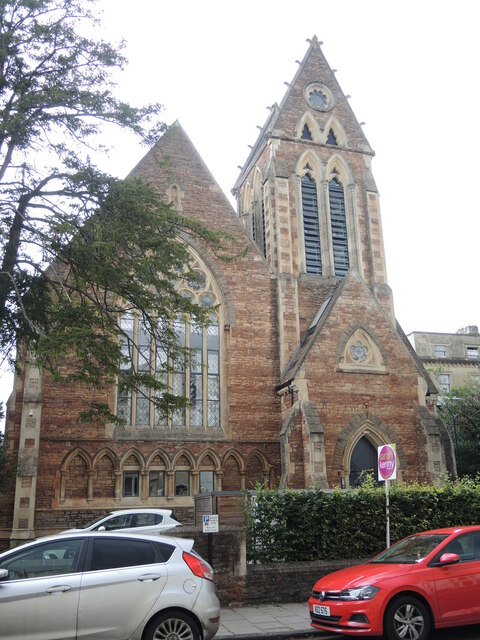
Image: © Neil Owen Taken: 2 Aug 2021
The church was founded in 1864 to provide more local meetings for the Unitarian movement, saving them a trip to Lewins Mead in the centre of town. It was designed by Pope and Bindon and cost £6,000. The course of its service ended in February, 1989 and was sold off, with the intention of demolition and construction of residential units. However, a protest proved strong enough; the building was retained and converted into offices.
Images are licensed for reuse under creativecommons.org/licenses/by-sa/2.0
Image Location
Latitude
51.461403
Longitude
-2.610403