Clevedon Waterworks Building
Introduction
The photograph on this page of Clevedon Waterworks Building by Brian Westlake as part of the Geograph project.
The Geograph project started in 2005 with the aim of publishing, organising and preserving representative images for every square kilometre of Great Britain, Ireland and the Isle of Man.

There are currently over 7.5m images from over 14,400 individuals and you can help contribute to the project by visiting https://www.geograph.org.uk
Clevedon Waterworks Building
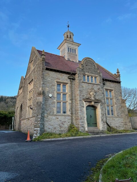
Image: © Brian Westlake Taken: 7 Dec 2021
The vane on top of the building was used as reference point called an intersected station during Ordnance Survey mapping and on the front to left of the drain pipe is a cut bench mark used for plotting contours. See https://www.geograph.org.uk/photo/7049431 for a close-up of the mark and https://www.bench-marks.org.uk/bm70195 for details.
Images are licensed for reuse under creativecommons.org/licenses/by-sa/2.0
Image Location
Latitude
51.441046
Longitude
-2.822209