Temperature inversion in Lunedale
Introduction
The photograph on this page of Temperature inversion in Lunedale by Richard Webb as part of the Geograph project.
The Geograph project started in 2005 with the aim of publishing, organising and preserving representative images for every square kilometre of Great Britain, Ireland and the Isle of Man.

There are currently over 7.5m images from over 14,400 individuals and you can help contribute to the project by visiting https://www.geograph.org.uk
Temperature inversion in Lunedale
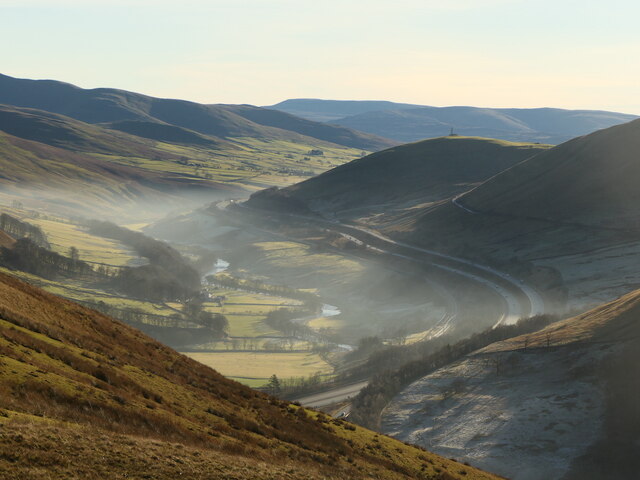
Image: © Richard Webb Taken: 19 Dec 2021
The fog has almost evaporated at this point but was still thick over Morecambe Bay and well to the south. The West Coast Main Line and M6 squeeze through the westernmost of the Yorkshire Dales, a narrow corridor between the Lake District National Park (foreground) and the Yorkshire Dales National Park over the river.
Images are licensed for reuse under creativecommons.org/licenses/by-sa/2.0
Image Location
Latitude
54.398504
Longitude
-2.594513