The Windmill pub on Windmill Hill
Introduction
The photograph on this page of The Windmill pub on Windmill Hill by Neil Owen as part of the Geograph project.
The Geograph project started in 2005 with the aim of publishing, organising and preserving representative images for every square kilometre of Great Britain, Ireland and the Isle of Man.

There are currently over 7.5m images from over 14,400 individuals and you can help contribute to the project by visiting https://www.geograph.org.uk
The Windmill pub on Windmill Hill
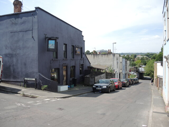
Image: © Neil Owen Taken: 23 Jul 2021
A corner pub in a Victorian suburb of Bristol. Underneath this everyday image is a heated and pasionate campaign to keep the pub. The current owners closed it in March, 2020, (before lockdowns!) as it was not making money, to the great alarm of the locals. Plans were brought before the council to convert it into flats, but residents protested vehemently, citing it was a precious community asset. After a heated exchange, the plans were thrown out. The people gathered a fund-raising effort to buy it outright but the owners rejected the offer, much to their annoyance. Now begins the long drawn out round of appeals and counter appeals, which will only lead to more neglect and upset. Will it ever be a pub or will it be homes? Old maps show it as a pub from about the early twentieth century, from which it may well have been two terraced houses knocked into one to become the pub.
Images are licensed for reuse under creativecommons.org/licenses/by-sa/2.0
Image Location
Latitude
51.439545
Longitude
-2.59443