Railway bridge over Hawks Road
Introduction
The photograph on this page of Railway bridge over Hawks Road by Stephen Craven as part of the Geograph project.
The Geograph project started in 2005 with the aim of publishing, organising and preserving representative images for every square kilometre of Great Britain, Ireland and the Isle of Man.

There are currently over 7.5m images from over 14,400 individuals and you can help contribute to the project by visiting https://www.geograph.org.uk
Railway bridge over Hawks Road
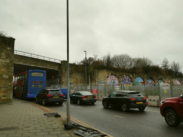
Image: © Stephen Craven Taken: 4 Dec 2021
See Image for a view from the other side. The Baric Systems building shown to the right of this view in Image has now been demolished, leaving a clear view of the arched viaduct to the right that led into the old Oakwellgate station This was "situated on a 32ft high artificial mound surrounded on three sides by a brick and masonry retaining wall" [Source: https://www.twsitelines.info/SMR/4368 ]. It is still shown as 'Goods Sta' on the 1967 OS map, but beyond the wall is now the car park for the nearby Sage Centre. Traffic was queuing for at least 300 metres for the junction with the A167 (Tyne Bridge approach).
Images are licensed for reuse under creativecommons.org/licenses/by-sa/2.0
Image Location
Latitude
54.966097
Longitude
-1.599808