Park and modern housing near Oxley, Wolverhampton
Introduction
The photograph on this page of Park and modern housing near Oxley, Wolverhampton by Roger Kidd as part of the Geograph project.
The Geograph project started in 2005 with the aim of publishing, organising and preserving representative images for every square kilometre of Great Britain, Ireland and the Isle of Man.

There are currently over 7.5m images from over 14,400 individuals and you can help contribute to the project by visiting https://www.geograph.org.uk
Park and modern housing near Oxley, Wolverhampton
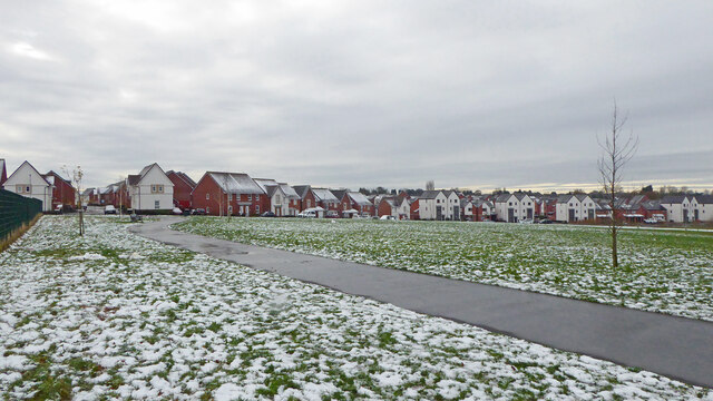
Image: © Roger Kidd Taken: 29 Nov 2021
The St Modwen Developments regeneration on the 88 acre former Goodyear tyre factory site has continued for many years, with housing and this relandscaped Wingfoot Park (now named Goodyear Neighbourhood Park and reopened in 2018). The snow is a remnant of the 6-8cm fall dumped by Storm Arwen three days earlier. Looking south-west towards Goodwood Drive and Ranger Drive.
Images are licensed for reuse under creativecommons.org/licenses/by-sa/2.0
Image Location
Latitude
52.615075
Longitude
-2.12653