St Bernard's House, Broad Street
Introduction
The photograph on this page of St Bernard's House, Broad Street by Richard Law as part of the Geograph project.
The Geograph project started in 2005 with the aim of publishing, organising and preserving representative images for every square kilometre of Great Britain, Ireland and the Isle of Man.

There are currently over 7.5m images from over 14,400 individuals and you can help contribute to the project by visiting https://www.geograph.org.uk
St Bernard's House, Broad Street
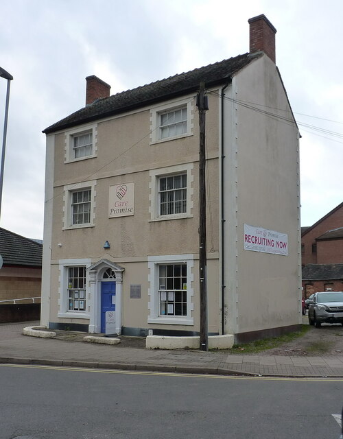
Image: © Richard Law Taken: 4 Nov 2020
Named on the maps at one time as Stafford Catholic Club, St Bernard's House dates from around 1810 and was Grade II listed https://britishlistedbuildings.co.uk/101195375-st-bernards-house-stafford#.YaeujdDP3IU & https://historicengland.org.uk/listing/the-list/list-entry/1195375 in 1971. It appears to be in use now as offices.
Images are licensed for reuse under creativecommons.org/licenses/by-sa/2.0
Image Location
Latitude
52.807657
Longitude
-2.11991