Hawker's Cove
Introduction
The photograph on this page of Hawker's Cove by Derek Harper as part of the Geograph project.
The Geograph project started in 2005 with the aim of publishing, organising and preserving representative images for every square kilometre of Great Britain, Ireland and the Isle of Man.

There are currently over 7.5m images from over 14,400 individuals and you can help contribute to the project by visiting https://www.geograph.org.uk
Hawker's Cove
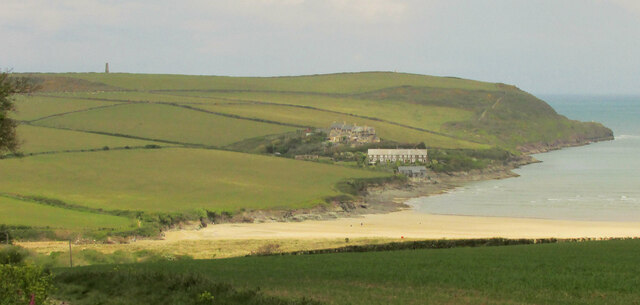
Image: © Derek Harper Taken: 17 May 2021
A detail of Image], centring on the former coastguard and pilot cottages by the old lifeboat station on the Camel estuary, with the beach at Harbour Cove nearer at hand. On the left is the daymark navigation tower https://historicengland.org.uk/listing/the-list/list-entry/1289603 shown in most of the images at https://www.geograph.org.uk/gridref/SW9178?centi=SW910784 .
Images are licensed for reuse under creativecommons.org/licenses/by-sa/2.0
Image Location
Latitude
50.56121
Longitude
-4.949453