Bolton Bridge [3]
Introduction
The photograph on this page of Bolton Bridge [3] by Michael Dibb as part of the Geograph project.
The Geograph project started in 2005 with the aim of publishing, organising and preserving representative images for every square kilometre of Great Britain, Ireland and the Isle of Man.

There are currently over 7.5m images from over 14,400 individuals and you can help contribute to the project by visiting https://www.geograph.org.uk
Bolton Bridge [3]
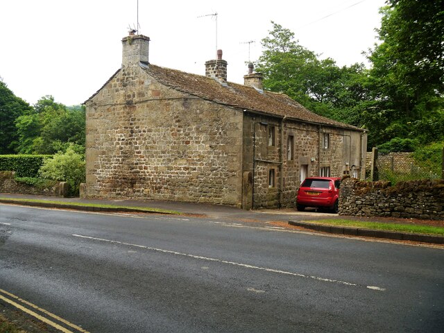
Image: © Michael Dibb Taken: 23 Jun 2021
Devonshire Cottages, alongside the B6160 road, are mid 18th century. Constructed of coursed rubble stone with freestone dressings under a stone slate roof. There is another view of the cottages at Image Listed, grade II, with details at: https://historicengland.org.uk/listing/the-list/list-entry/1166709 Bolton Bridge is a bridge carrying the A59 road across the River Wharfe. The original bridge replaced a ferry and was itself bypassed when the A59 was straightened and a new bridge constructed in the 1990s. The hamlet of the same name grew up around the river crossing.
Images are licensed for reuse under creativecommons.org/licenses/by-sa/2.0
Image Location


Leaflet Map data © OpenStreetMap
Latitude
53.973382
Longitude
-1.894923