All Saints Church sundial
Introduction
The photograph on this page of All Saints Church sundial by Leanmeanmo as part of the Geograph project.
The Geograph project started in 2005 with the aim of publishing, organising and preserving representative images for every square kilometre of Great Britain, Ireland and the Isle of Man.

There are currently over 7.5m images from over 14,400 individuals and you can help contribute to the project by visiting https://www.geograph.org.uk
All Saints Church sundial
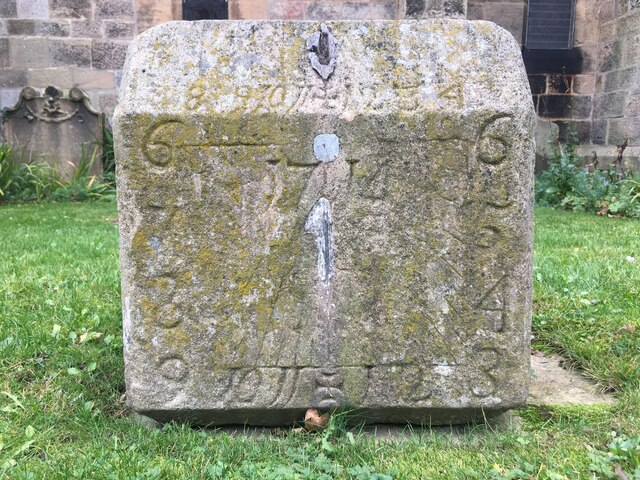
Image: © Leanmeanmo Taken: 13 Nov 2021
Clearly dated 1714 and with multiple dials, sadly missing its gnomons. This substantial block of stone has apparently been removed from its original location and now rests on the ground beside the porch. Excellent description at https://www.pendulumpublications.com/the-rothbury-sundials.html
Images are licensed for reuse under creativecommons.org/licenses/by-sa/2.0
Image Location
Latitude
55.308818
Longitude
-1.910649