The former Malvern public house, Malvern Way, Hastings
Introduction
The photograph on this page of The former Malvern public house, Malvern Way, Hastings by Patrick Roper as part of the Geograph project.
The Geograph project started in 2005 with the aim of publishing, organising and preserving representative images for every square kilometre of Great Britain, Ireland and the Isle of Man.

There are currently over 7.5m images from over 14,400 individuals and you can help contribute to the project by visiting https://www.geograph.org.uk
The former Malvern public house, Malvern Way, Hastings
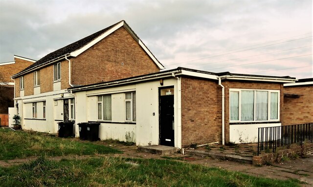
Image: © Patrick Roper Taken: 4 Nov 2021
The pub, now converted to residential use, seems to have consisted of the rectangular building in the foreground. It opened, as the New Broom, in 1970 and was closed in 2008 (2005 in some sources). The earlier name reflects the Broomgrove district where it lies. The new name of The Malvern is from Malvern Way, the road it is in. There are many roads in this area named after hill ranges: Pennine Rise, Mendip Gardens, The Cheviots, Quantock Gardens.
Images are licensed for reuse under creativecommons.org/licenses/by-sa/2.0
Image Location
Latitude
50.873893
Longitude
0.597526