Skipton Castle [17]
Introduction
The photograph on this page of Skipton Castle [17] by Michael Dibb as part of the Geograph project.
The Geograph project started in 2005 with the aim of publishing, organising and preserving representative images for every square kilometre of Great Britain, Ireland and the Isle of Man.

There are currently over 7.5m images from over 14,400 individuals and you can help contribute to the project by visiting https://www.geograph.org.uk
Skipton Castle [17]
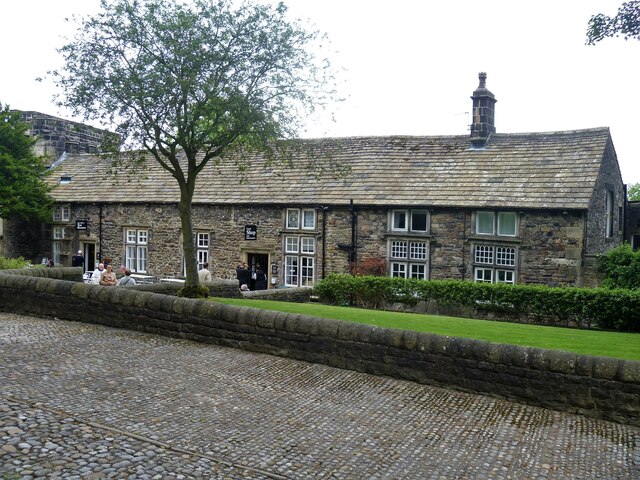
Image: © Michael Dibb Taken: 20 Jun 2021
This long range is attached to the outer gatehouse and is now the castle's tearooms and shop. Probably built in the mid 17th century of rubble stone with ashlar dressings under a stone flag roof. Listed, grade II, with details at: https://historicengland.org.uk/listing/the-list/list-entry/1131905 Skipton Castle was first built in 1090 as a motte and bailey castle. Soon rebuilt in stone, the castle was strengthened in the early 14th century to withstand attacks from the Scots. After holding out for three years as the last Royalist stronghold in the north of England in the Civil War, the castle was slighted but skilfully repaired. Regarded today as one of the best preserved medieval castles in England. Listed, grade I, with details at: https://historicengland.org.uk/listing/the-list/list-entry/1316962 Skipton is a market town in North Yorkshire, some 27 miles northwest of Leeds. On the southern edge of the Yorkshire Dales National Park, it is now an important tourist destination. The town expanded after the construction of Skipton Castle in the 11th century. The Leeds and Liverpool Canal runs through the town and the River Aire flows just to the southwest. The name Skipton means 'sheep-town'.
Images are licensed for reuse under creativecommons.org/licenses/by-sa/2.0
Image Location
Latitude
53.96354
Longitude
-2.015815