Churchfield Recreation Ground
Introduction
The photograph on this page of Churchfield Recreation Ground by Stephen McKay as part of the Geograph project.
The Geograph project started in 2005 with the aim of publishing, organising and preserving representative images for every square kilometre of Great Britain, Ireland and the Isle of Man.

There are currently over 7.5m images from over 14,400 individuals and you can help contribute to the project by visiting https://www.geograph.org.uk
Churchfield Recreation Ground
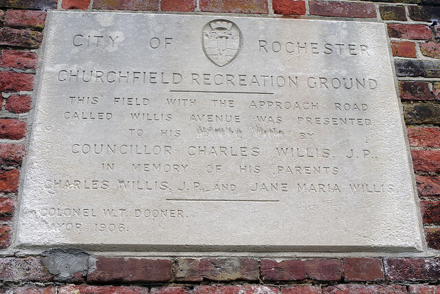
Image: © Stephen McKay Taken: 22 Oct 2021
This plaque is self-explanatory but what is curious is the way that two words have been deliberately but very crudely redacted. Close examination suggests they possibly read 'native city' which would make contextual sense. Rochester actually lost its city status in 1998 (apparently due to an oversight) but was certainly considered a city in 1906. In any case, why anyone should object to this wording is a mystery.
Images are licensed for reuse under creativecommons.org/licenses/by-sa/2.0
Image Location
Latitude
51.38456
Longitude
0.498858