Brown's Buildings, Kenton Bank Foot
Introduction
The photograph on this page of Brown's Buildings, Kenton Bank Foot by Phil Thirkell as part of the Geograph project.
The Geograph project started in 2005 with the aim of publishing, organising and preserving representative images for every square kilometre of Great Britain, Ireland and the Isle of Man.

There are currently over 7.5m images from over 14,400 individuals and you can help contribute to the project by visiting https://www.geograph.org.uk
Brown's Buildings, Kenton Bank Foot
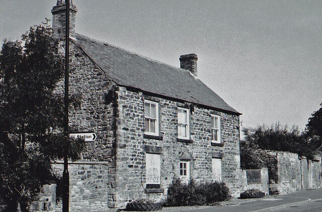
Image: © Phil Thirkell Taken: Unknown
See the description in previous image Image Photograph not precisely dated but almost certainly late 1990s before being demolished for the building of the Twin Farms public house. The "Station" sign on the lamp-post is still in the same position indicating the precise location.
Images are licensed for reuse under creativecommons.org/licenses/by-sa/2.0
Image Location
Latitude
55.015214
Longitude
-1.67798