Canal aqueduct over a footpath
Introduction
The photograph on this page of Canal aqueduct over a footpath by Richard Law as part of the Geograph project.
The Geograph project started in 2005 with the aim of publishing, organising and preserving representative images for every square kilometre of Great Britain, Ireland and the Isle of Man.

There are currently over 7.5m images from over 14,400 individuals and you can help contribute to the project by visiting https://www.geograph.org.uk
Canal aqueduct over a footpath
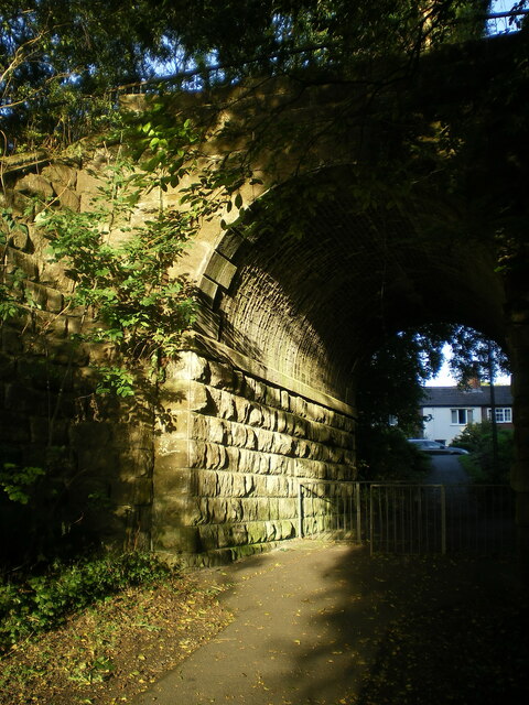
Image: © Richard Law Taken: 11 Oct 2021
The aqueduct is now a bridge carrying the Silkin Way footpath. But it was originally built around 1788 as an Accommodation Bridge, to take the Shropshire Canal Navigation (a tub-boat canal) over a track; the canal was subsequently converted in the late 1850s to the Coalport Branch Line of the London & North West Railway, which then closed in 1960 and is now the Silkin Way. The bridge was Grade II listed https://britishlistedbuildings.co.uk/101377111-canal-aqueduct-at-national-grid-reference-695-057-dawley-hamlets#.YWXfLxrMLIU & https://historicengland.org.uk/listing/the-list/list-entry/1377111 in 1993, and restored in 2001.
Images are licensed for reuse under creativecommons.org/licenses/by-sa/2.0
Image Location
Latitude
52.647757
Longitude
-2.452194