Pair of former ribbon weavers' houses, Foleshill Road, Coventry
Introduction
The photograph on this page of Pair of former ribbon weavers' houses, Foleshill Road, Coventry by A J Paxton as part of the Geograph project.
The Geograph project started in 2005 with the aim of publishing, organising and preserving representative images for every square kilometre of Great Britain, Ireland and the Isle of Man.

There are currently over 7.5m images from over 14,400 individuals and you can help contribute to the project by visiting https://www.geograph.org.uk
Pair of former ribbon weavers' houses, Foleshill Road, Coventry
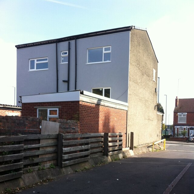
Image: © A J Paxton Taken: 9 Oct 2021
This is a pair of semi-detached houses with protruding shop fronts at 799 & 801 Foleshill Road, seen from the rear. This area of Foleshill was known as Parting of the Heaths and possessed a number of three-storey weavers' houses with the tall 'top shops' that housed the high Jacquard looms. A postcard from 1906 shows groups of these houses facing onto Foleshill Road and is reproduced on p47 of David Fry & Albert Smith's The Coventry we have lost: Forgotten Foleshill (Simanda Press, 2018). These two much-altered houses are the only survivors.
Images are licensed for reuse under creativecommons.org/licenses/by-sa/2.0
Image Location
Latitude
52.434808
Longitude
-1.495287