Former Lowland Kirk
Introduction
The photograph on this page of Former Lowland Kirk by Anne Burgess as part of the Geograph project.
The Geograph project started in 2005 with the aim of publishing, organising and preserving representative images for every square kilometre of Great Britain, Ireland and the Isle of Man.

There are currently over 7.5m images from over 14,400 individuals and you can help contribute to the project by visiting https://www.geograph.org.uk
Former Lowland Kirk
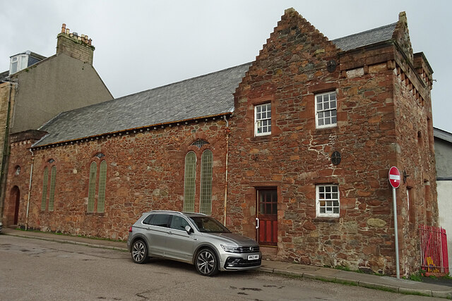
Image: © Anne Burgess Taken: 1 Oct 2021
The building dates from 1706 but was extensively restored in 1904. It is a Category B Listed Building. See http://portal.historicenvironment.scot/designation/LB22944 for its history and a detailed description.
Images are licensed for reuse under creativecommons.org/licenses/by-sa/2.0
Image Location


Leaflet Map data © OpenStreetMap
Latitude
55.423429
Longitude
-5.60363