Old Boundary Marker on the B3180 on Woodbury Common
Introduction
The photograph on this page of Old Boundary Marker on the B3180 on Woodbury Common by T Jenkinson as part of the Geograph project.
The Geograph project started in 2005 with the aim of publishing, organising and preserving representative images for every square kilometre of Great Britain, Ireland and the Isle of Man.

There are currently over 7.5m images from over 14,400 individuals and you can help contribute to the project by visiting https://www.geograph.org.uk
Old Boundary Marker on the B3180 on Woodbury Common
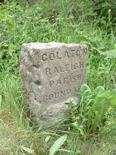
Image: © T Jenkinson Taken: 18 Jun 2006
Parish Boundary Marker on the southeast side of the B3180 on Woodbury Common. On the boundary of Woodbury and Colaton Raleigh parishes. The reverse is inscribed for Woodbury Parish. See also https://www.geograph.org.uk/photo/2343381. Milestone Society National ID: DV_EMAY04pb
Images are licensed for reuse under creativecommons.org/licenses/by-sa/2.0
Image Location
Latitude
50.68621
Longitude
-3.357896