Old Boundary Marker on the boundary of the Tavistock Cricket Club on Whitchurch Down
Introduction
The photograph on this page of Old Boundary Marker on the boundary of the Tavistock Cricket Club on Whitchurch Down by T Jenkinson as part of the Geograph project.
The Geograph project started in 2005 with the aim of publishing, organising and preserving representative images for every square kilometre of Great Britain, Ireland and the Isle of Man.

There are currently over 7.5m images from over 14,400 individuals and you can help contribute to the project by visiting https://www.geograph.org.uk
Old Boundary Marker on the boundary of the Tavistock Cricket Club on Whitchurch Down
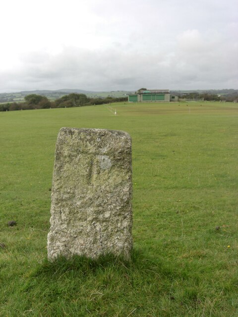
Image: © T Jenkinson Taken: 1 Oct 2012
Parish Boundary Marker, one of the circle of (six?) granite posts that form the boundary of the Tavistock Cricket Club on Whitchurch Down. Inscribed T and W on opposite faces. Until 1898 this was on the boundary of Tavistock and Whitchurch parishes, then until 1998 Tavistock Hamlets and Whitchurch, and now entirely in Tavistock parish Milestone Society National ID: DV_WCTV05pb
Images are licensed for reuse under creativecommons.org/licenses/by-sa/2.0
Image Location
Latitude
50.541644
Longitude
-4.136627