Old Boundary Marker on Old Laira Road, Plymouth
Introduction
The photograph on this page of Old Boundary Marker on Old Laira Road, Plymouth by T Jenkinson as part of the Geograph project.
The Geograph project started in 2005 with the aim of publishing, organising and preserving representative images for every square kilometre of Great Britain, Ireland and the Isle of Man.

There are currently over 7.5m images from over 14,400 individuals and you can help contribute to the project by visiting https://www.geograph.org.uk
Old Boundary Marker on Old Laira Road, Plymouth
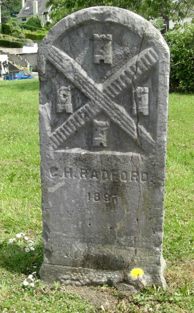
Image: © T Jenkinson Taken: 31 May 2012
Municipal Boundary Marker on the east side of the junction of the B3214 Old Laira Road and the A374 Embankment Road, Plymouth. Inscribed C.H. RADFORD / 1897 for Charles H Radford, mayor. Milestone Society National ID: DV_PCBS49pb
Images are licensed for reuse under creativecommons.org/licenses/by-sa/2.0
Image Location
Latitude
50.384745
Longitude
-4.099292