Old Milestone, A287, Folly Hill, Upper Hale
Introduction
The photograph on this page of Old Milestone, A287, Folly Hill, Upper Hale by Derek Renn as part of the Geograph project.
The Geograph project started in 2005 with the aim of publishing, organising and preserving representative images for every square kilometre of Great Britain, Ireland and the Isle of Man.

There are currently over 7.5m images from over 14,400 individuals and you can help contribute to the project by visiting https://www.geograph.org.uk
Old Milestone, A287, Folly Hill, Upper Hale
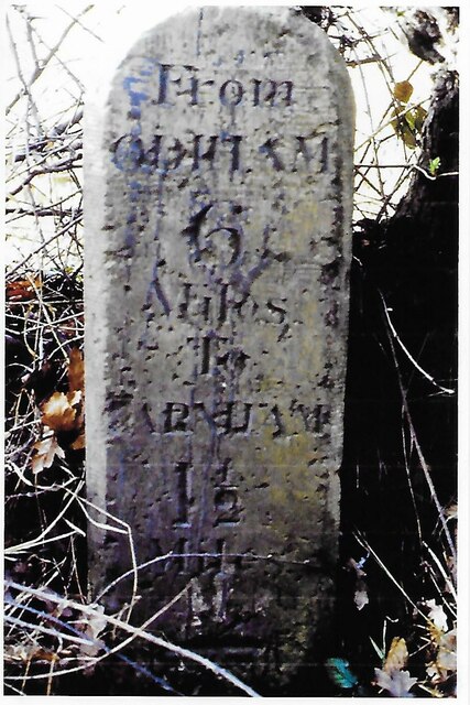
Image: © Derek Renn Taken: Unknown
The milestone is located 50m north of the junction with Heathyfields Road on the West side of the road in the hedge. Parish of Farnham (Waverley district). Carved stone post, Odiham stone design, erected by the Odiham & Farnham turnpike trust in the 18th century. Inscription reads:- FROM / ODIHAM / 6 / MILES / TO / FARNHAM / 1½ / MILES The date of the image is not known but is probably before 2001. Milestone Society National ID: SY_ODFA06
Images are licensed for reuse under creativecommons.org/licenses/by-sa/2.0
Image Location
Latitude
51.234508
Longitude
-0.811645