Old Boundary Marker on Emblance Downs, St Breward parish
Introduction
The photograph on this page of Old Boundary Marker on Emblance Downs, St Breward parish by P G Moore as part of the Geograph project.
The Geograph project started in 2005 with the aim of publishing, organising and preserving representative images for every square kilometre of Great Britain, Ireland and the Isle of Man.

There are currently over 7.5m images from over 14,400 individuals and you can help contribute to the project by visiting https://www.geograph.org.uk
Old Boundary Marker on Emblance Downs, St Breward parish
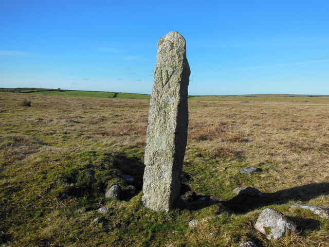
Image: © P G Moore Taken: Unknown
Estate Boundary Marker on the open moorland of Emblance Downs west of the De Lank waterworks and adjacent to the enclosed farmland of Ivey Farm. Clearly visible from the lane to the waterworks. St Breward parish. One of six stones which appear to have replaced a line of smaller stones that are shown on the 1842 St Breward tithe maps and which mark a portion of Emblance Downs under the ownership of William Morshead, who at the time, owned the nearby Ivey Farm. The stylised VI (with the letter I crossing the right-hand diagonal of the letter V) carved on these stones is thought to represent the name Ivey. The nature of the carving on these stones and the fact that they are not shown on the Ordnance Survey maps of the early 20C would indicate that they were erected in the first quarter of the century. Milestone Society National ID: CW_BREWAR16em
Images are licensed for reuse under creativecommons.org/licenses/by-sa/2.0
Image Location


Leaflet Map data © OpenStreetMap
Latitude
50.559591
Longitude
-4.64087