Moncreiffe Island
Introduction
The photograph on this page of Moncreiffe Island by Richard Webb as part of the Geograph project.
The Geograph project started in 2005 with the aim of publishing, organising and preserving representative images for every square kilometre of Great Britain, Ireland and the Isle of Man.

There are currently over 7.5m images from over 14,400 individuals and you can help contribute to the project by visiting https://www.geograph.org.uk
Moncreiffe Island
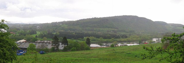
Image: © Richard Webb Taken: 3 May 2005
Taken from the road leading south out of Perth this image shows the island in the River Tay, backed by Kinnoull Hill. Moncreiffe or Friarton Island is taken up by allotments and a golf course.
Images are licensed for reuse under creativecommons.org/licenses/by-sa/2.0
Image Location


Leaflet Map data © OpenStreetMap
Latitude
56.378906
Longitude
-3.419929