Western end of cycle route, Broadlands
Introduction
The photograph on this page of Western end of cycle route, Broadlands by eswales as part of the Geograph project.
The Geograph project started in 2005 with the aim of publishing, organising and preserving representative images for every square kilometre of Great Britain, Ireland and the Isle of Man.

There are currently over 7.5m images from over 14,400 individuals and you can help contribute to the project by visiting https://www.geograph.org.uk
Western end of cycle route, Broadlands
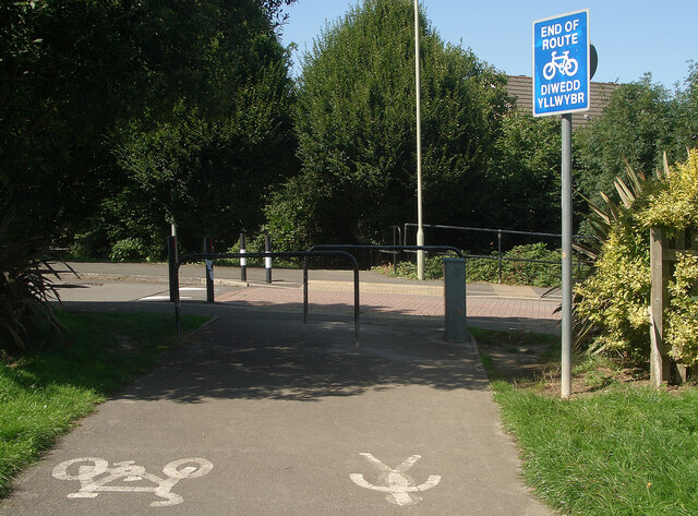
Image: © eswales Taken: 24 Aug 2021
The image shows the end of a cycle path at a spot on Heol Blandy in the north west of Broadlands. This is the end of the more northerly of two branches which maps indicate the cycle route at Broadlands divides into to the west of the B4622. Note the symbols on the ground which, for the safety and convenience of those about to set off along the path, indicate the separate sides of it which cyclists and pedestrians should use.
Images are licensed for reuse under creativecommons.org/licenses/by-sa/2.0
Image Location
Latitude
51.503636
Longitude
-3.610303