
Stretton Arm, Oxford Canal
Introduction
The photograph on this page of Stretton Arm, Oxford Canal by Christopher Hilton as part of the Geograph project.
The Geograph project started in 2005 with the aim of publishing, organising and preserving representative images for every square kilometre of Great Britain, Ireland and the Isle of Man.

There are currently over 7.5m images from over 14,400 individuals and you can help contribute to the project by visiting https://www.geograph.org.uk
Stretton Arm, Oxford Canal
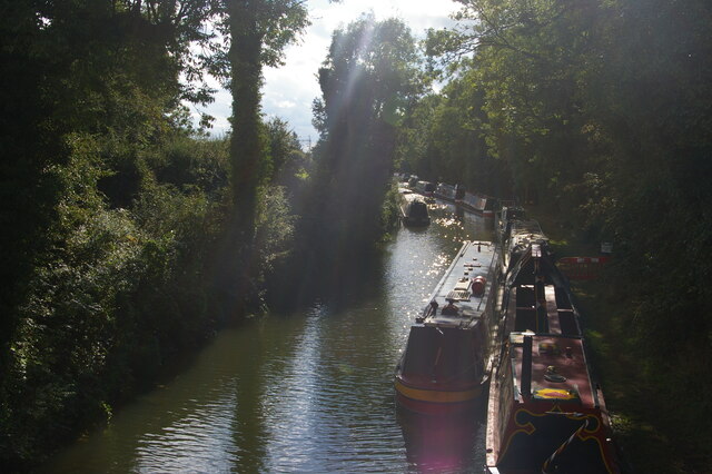
Image: © Christopher Hilton Taken: 10 Sep 2021
The Oxford Canal was one of the first generation of canals in the United Kingdom and was built following contours in a winding, circuitous route. In the 1820s the northern section, from Coventry to Braunston Junction (where it connected with the Grand Junction canal to London) was radically shortened by cutting off loops and meanders with embankments and cuttings. Some sections of the superseded loops remain in water and this is one, stretching a short way from the main line towards Stretton-under-Fosse: it is used for moorings and a boatyard.
Images are licensed for reuse under creativecommons.org/licenses/by-sa/2.0
Image Location

Latitude
52.424495
Longitude
-1.352759