
Todbusk lawn
Introduction
The photograph on this page of Todbusk lawn by Adrian Taylor as part of the Geograph project.
The Geograph project started in 2005 with the aim of publishing, organising and preserving representative images for every square kilometre of Great Britain, Ireland and the Isle of Man.

There are currently over 7.5m images from over 14,400 individuals and you can help contribute to the project by visiting https://www.geograph.org.uk
Todbusk lawn
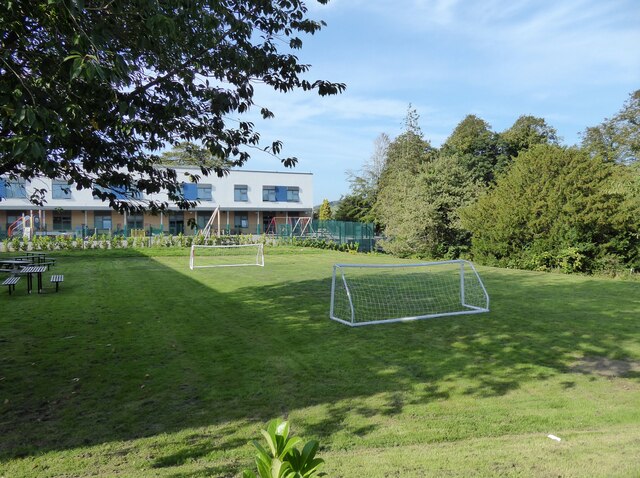
Image: © Adrian Taylor Taken: 8 Sep 2021
Formerly the rear lawn of Todbusk, a large private house built for Barrow iron foundry owner David Caird, this old lawn has raised edges which enabled it to be flooded with shallow water in winter to create an ice rink. The Sandside Lodge School building in the background stands just beyond where Todbusk used to stand overlooking the lawn and garden. Todbusk became the offices of Ulverston Urban District Council which was abolished on Local Government Reorganisation in 1974 and after a further period of local authority use it was demolished to make way for the Sandside Lodge School building, a facility for children with special educational needs.
Images are licensed for reuse under creativecommons.org/licenses/by-sa/2.0
Image Location

Latitude
54.190675
Longitude
-3.093968