Old Boundary Marker on Emmanuel Road, London SW12
Introduction
The photograph on this page of Old Boundary Marker on Emmanuel Road, London SW12 by R Heywood as part of the Geograph project.
The Geograph project started in 2005 with the aim of publishing, organising and preserving representative images for every square kilometre of Great Britain, Ireland and the Isle of Man.

There are currently over 7.5m images from over 14,400 individuals and you can help contribute to the project by visiting https://www.geograph.org.uk
Old Boundary Marker on Emmanuel Road, London SW12
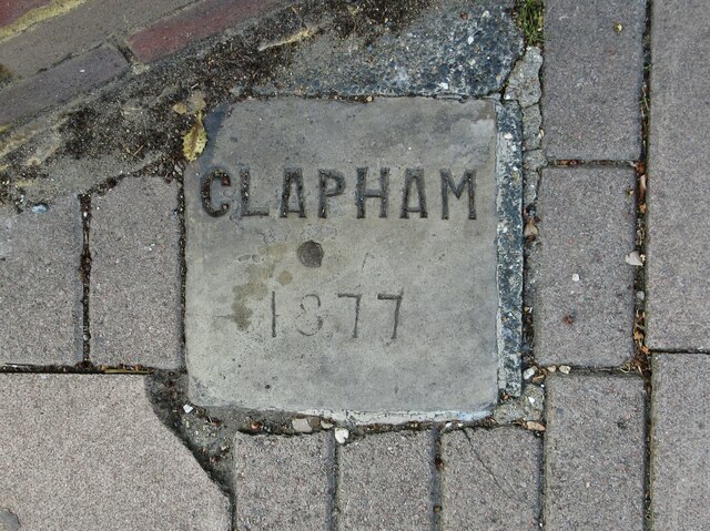
Image: © R Heywood Taken: 5 Sep 2021
Parish Boundary Marker set in the pavement on the northwest side of the junction of Emmanuel Road and the B221 Thornton Road, both SW12. On the former boundary of Clapham and Streatham parishes, now Lambeth Borough. Milestone Society National ID: SY_CLAP13pb
Images are licensed for reuse under creativecommons.org/licenses/by-sa/2.0
Image Location
Latitude
51.443014
Longitude
-0.133007