Direction Sign ? Signpost in Potto village
Introduction
The photograph on this page of Direction Sign ? Signpost in Potto village by H Jones as part of the Geograph project.
The Geograph project started in 2005 with the aim of publishing, organising and preserving representative images for every square kilometre of Great Britain, Ireland and the Isle of Man.

There are currently over 7.5m images from over 14,400 individuals and you can help contribute to the project by visiting https://www.geograph.org.uk
Direction Sign ? Signpost in Potto village
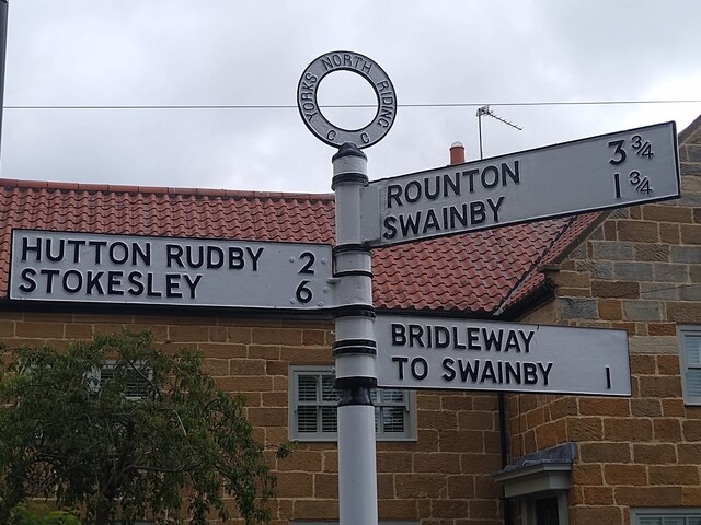
Image: © H Jones Taken: 2 Sep 2021
Located on the northeast side of the T junction of Station Lane, Cooper Lane and Butcher Lane in Potto parish. 3 arms and annulus finial. The Swaiby bridleway arm is a replacement at some time after 2009. Milestone Society National ID: YN_NZ4703
Images are licensed for reuse under creativecommons.org/licenses/by-sa/2.0
Image Location
Latitude
54.425979
Longitude
-1.270634