Presteigne houses [15]
Introduction
The photograph on this page of Presteigne houses [15] by Michael Dibb as part of the Geograph project.
The Geograph project started in 2005 with the aim of publishing, organising and preserving representative images for every square kilometre of Great Britain, Ireland and the Isle of Man.

There are currently over 7.5m images from over 14,400 individuals and you can help contribute to the project by visiting https://www.geograph.org.uk
Presteigne houses [15]
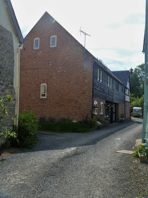
Image: © Michael Dibb Taken: 2 Jun 2021
Now converted to a dwelling, this range with stable, byre and hayloft was built in 1740. Partly of red brick and partly of box frame construction with wattle and daub infill and some weatherboard cladding to the upper floor under a corrugated iron roof. This is the earliest dated brick building in Radnorshire. Listed, grade II, with details at: https://cadwpublic-api.azurewebsites.net/reports/listedbuilding/FullReport?lang=&id=8836 Presteigne is a market town, set on the south bank of the River Lugg, some 19 miles northwest of Hereford and 16 miles east of Llandrindod Wells. The Welsh /English border wraps around three sides of the town, which probably began as a small settlement around a Minster church. Formerly the county town of the historic county of Radnorshire, it remains quiet, picturesque and unspoilt.
Images are licensed for reuse under creativecommons.org/licenses/by-sa/2.0
Image Location
Latitude
52.274833
Longitude
-3.003173