Effingham Road
Introduction
The photograph on this page of Effingham Road by Ian Capper as part of the Geograph project.
The Geograph project started in 2005 with the aim of publishing, organising and preserving representative images for every square kilometre of Great Britain, Ireland and the Isle of Man.

There are currently over 7.5m images from over 14,400 individuals and you can help contribute to the project by visiting https://www.geograph.org.uk
Effingham Road
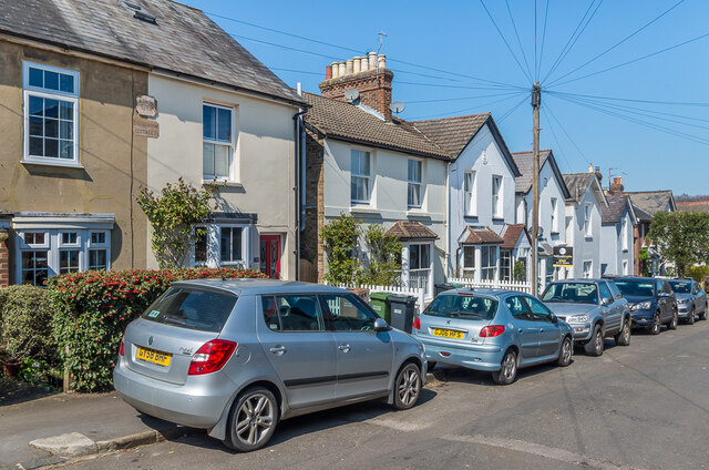
Image: © Ian Capper Taken: 19 Apr 2021
Victorian housing in Effingham Road. The nearest pair has plaques reading Effingham Cottages and CRK 1878, with ones in the gables of the houses to the right of the centre of the photo reading MH 1870, EB 1869 and Laurel Cottage respectively.
Images are licensed for reuse under creativecommons.org/licenses/by-sa/2.0
Image Location
Latitude
51.232653
Longitude
-0.19999