North shore of Trimpley Reservoir, Worcestershire
Introduction
The photograph on this page of North shore of Trimpley Reservoir, Worcestershire by Roger Kidd as part of the Geograph project.
The Geograph project started in 2005 with the aim of publishing, organising and preserving representative images for every square kilometre of Great Britain, Ireland and the Isle of Man.

There are currently over 7.5m images from over 14,400 individuals and you can help contribute to the project by visiting https://www.geograph.org.uk
North shore of Trimpley Reservoir, Worcestershire
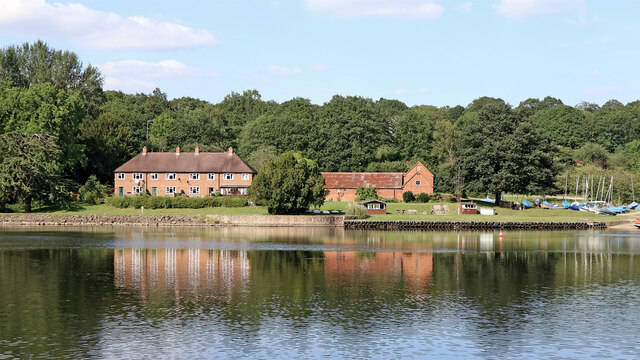
Image: © Roger Kidd Taken: 23 Aug 2021
The converted central buildings were formerly part of Eymore Farm, but are now the clubhouse of Trimpley Sailing Club. The four terraced houses are 3-6 Eymore Green.
Images are licensed for reuse under creativecommons.org/licenses/by-sa/2.0
Image Location


Leaflet Map data © OpenStreetMap
Latitude
52.407971
Longitude
-2.341293