War memorial
Introduction
The photograph on this page of War memorial by Michael Dibb as part of the Geograph project.
The Geograph project started in 2005 with the aim of publishing, organising and preserving representative images for every square kilometre of Great Britain, Ireland and the Isle of Man.

There are currently over 7.5m images from over 14,400 individuals and you can help contribute to the project by visiting https://www.geograph.org.uk
War memorial
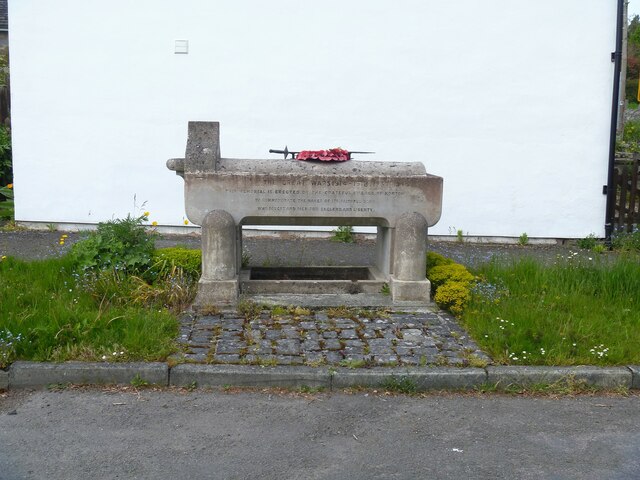
Image: © Michael Dibb Taken: 1 Jun 2021
At the side of Mynd Road stands this unusual, practical war memorial in the form of a horse trough and drinking fountain. The trough is constructed of concrete and is seen in context at Image Listed, grade II, with details at: https://cadwpublic-api.azurewebsites.net/reports/listedbuilding/FullReport?lang=&id=23934 Norton is a small, rural villages astride the B4355 road some 2 miles north of Presteigne and some 3½ miles south of Knighton. The village was a planned settlement around the Norman castle.
Images are licensed for reuse under creativecommons.org/licenses/by-sa/2.0
Image Location
Latitude
52.298767
Longitude
-3.021897